Activities
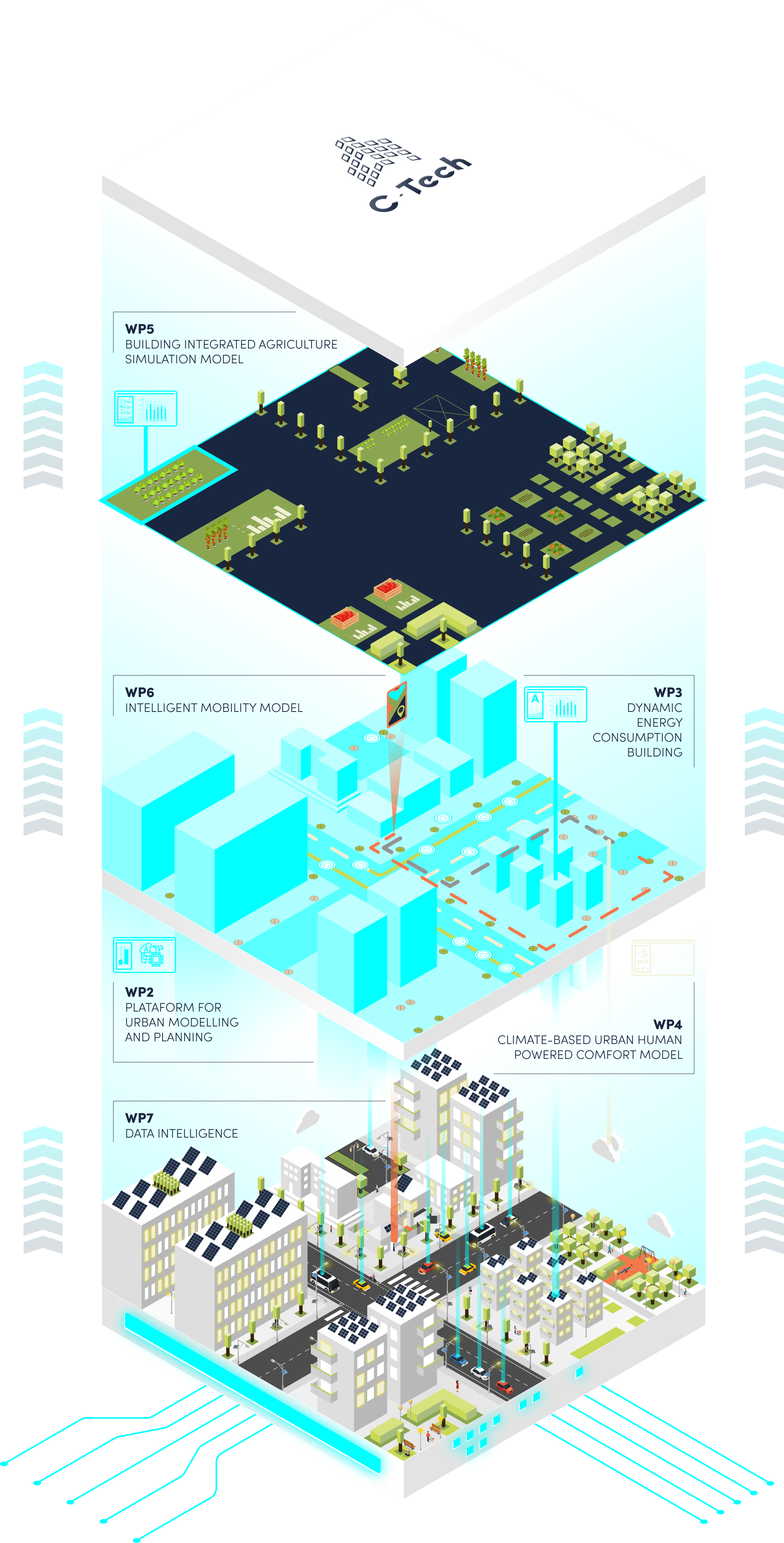
The project wants to deliver to the market a set of reliable simulators which will empower local authorities in the definition of new policies and measures to tackle climate change and foster environmental sustainability. The pursuit these objectives involves the execution of an action plan, structured in 9 correlated and complementary Activities, covering all stages of the product development cycle. The adopted research methodology combines industrial research with experimental development, ensuring continuous validation and feedback integration
Activity 1 - Project coordination and management
As its name indicates – is devoted to project’s executive coordination and technical management, emphasizing the importance attached to the effective coordination of all working teams and the compliance of the established goals, budget and timetable.
Activity 2 - Platform for urban modelling and planning (PUMP)
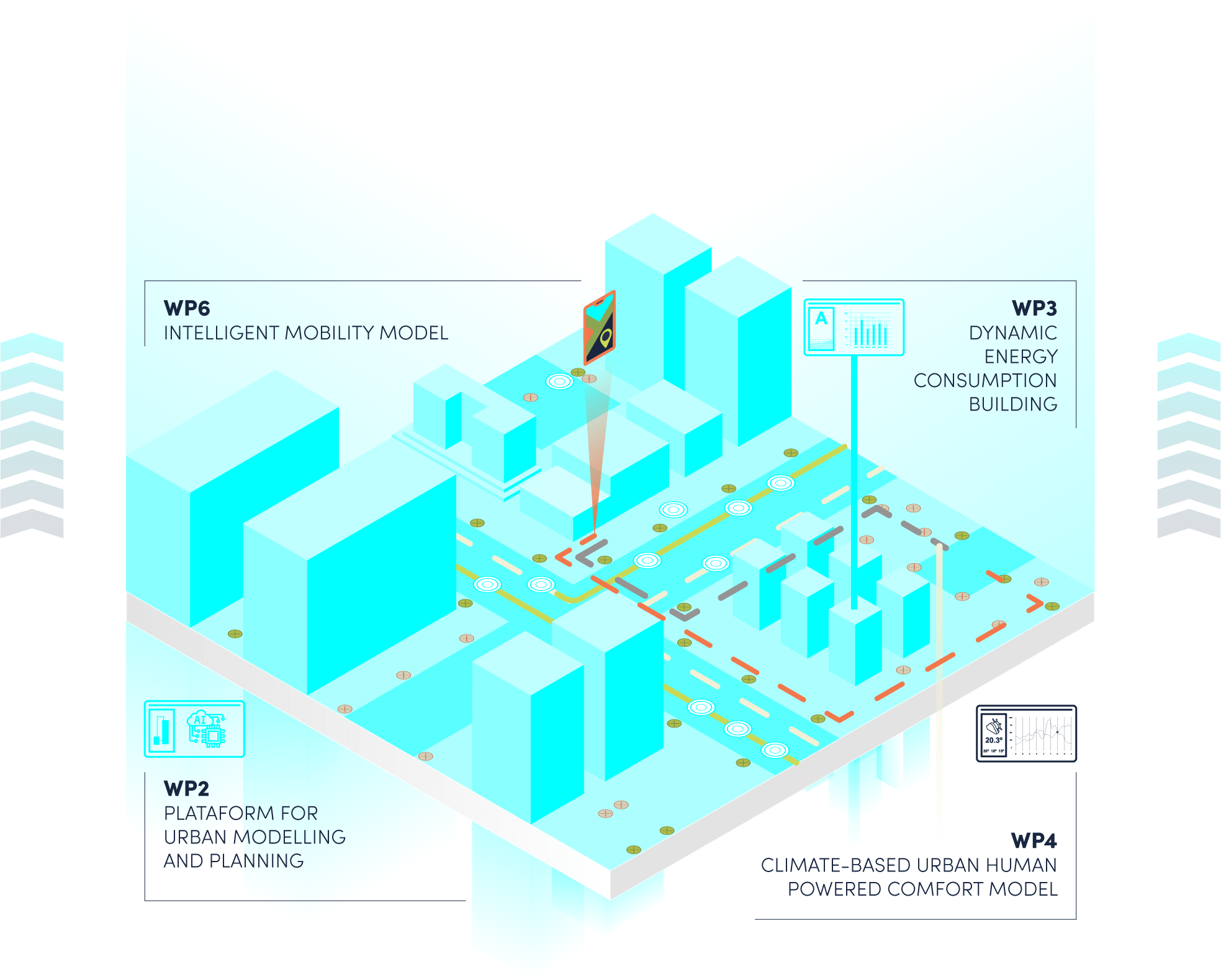
Represents the project’s operational starting point; based on the previous SusCity platform (co-developed by MIT and IST), this Activity is focused on settling up the framework to expand it and enrich it. This Activity aims at consolidating various data sets into a single data model, by constructing a data lake (in which all georeferenced data, building construction characteristics, statistical data on its occupants and mobility infrastructures will be stored and consolidated) which will be associated to the construction of building archetypes. Therefore, all the work to be carried out within Activities 3, 4, 5, 6 and 7 will have its basis on Activity 2.
Activity 3 - Dynamic Energy Consumption Building Model (DECB)
This activity is directly linked to Activity 2 and its main objective is to research and develop a dynamic urban, multi-building energy model which, by bringing together climate and building characteristics and its interactions, and an activity-based model to represent building utilization (making use of mobile phone usage), will enable the delivery of accurate predictive energy consumption scenarios. The DECB will be enabled with a feature where a set of predefined rehabilitation strategies (such as the inclusion of solar panels, the substitution of windows or adding insulation in the walls) will be made available to allow users to easily simulate the impact of its adoption both in energy consumption and in carbon reductions.
Activity 4 - Climate-based urban human powered comfort model
Marks the beginning of another project step, this time dedicated to mobility. Specifically, this activity stands as the first stage for the user’s interface mobility planner (envisaged on Activity 6) and focuses on developing an outdoor comfort model for Lisbon, by creating simulation methods that support real time predictions of near-biometeorological indices across a neighborhood, comparable to highly localized weather service. The resulting model will be integrated in activity 6, giving origin to a final app to be deployed to users. Following a holistic approach, the data collected in Activity 2 – such as light quantity and quality – and which will power the building simulation models, will also be the base to simulate the building’s potential to hydroponics. Specifically, within Activity 5, a model of plant growth will be developed and integrated with the thermal and climate model with resolution to address specific building locations in order to develop a set of BIA scenarios to highlight different levels of use of hydroponic technologies, their location in building and its feasibility.
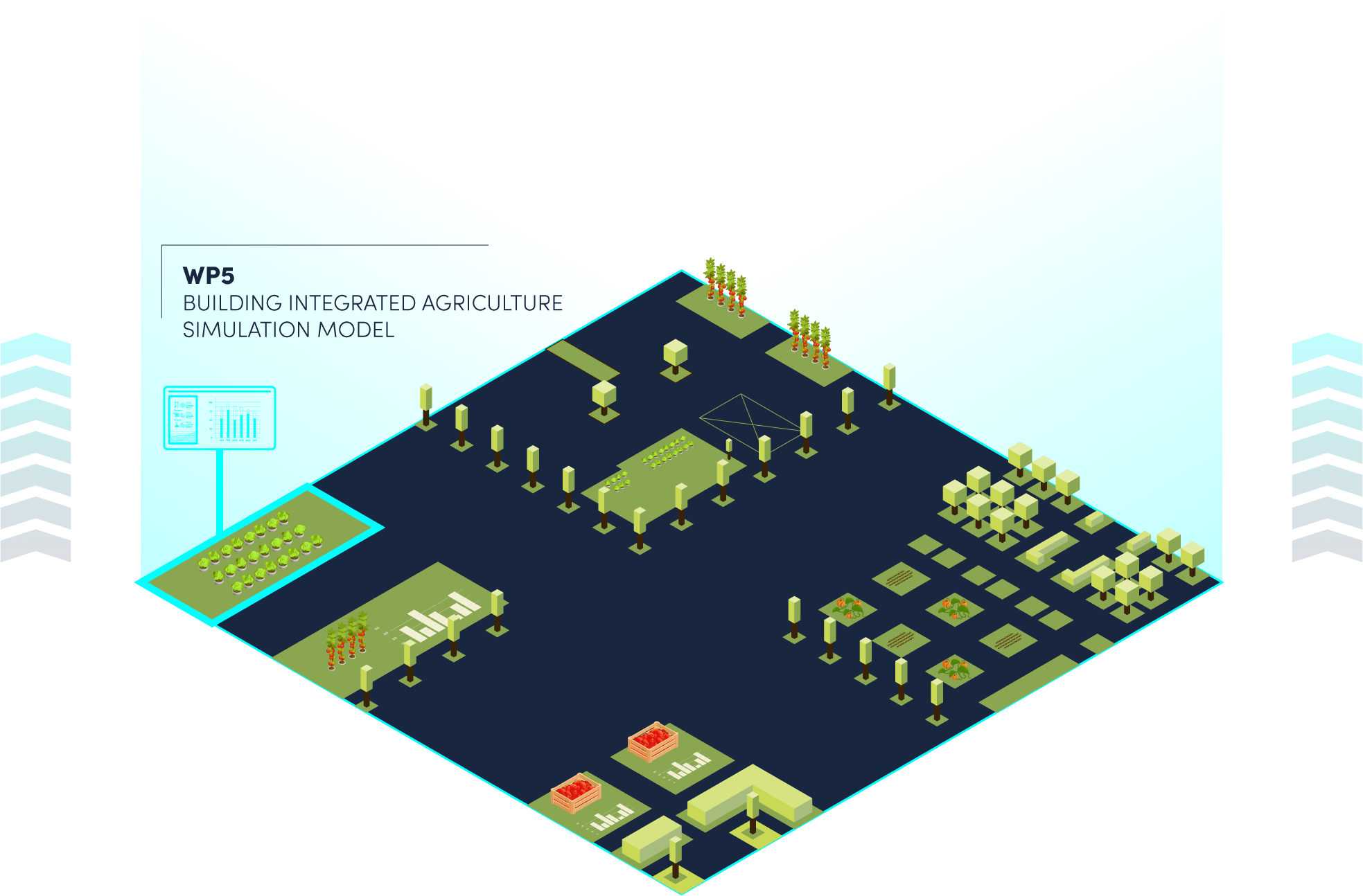
Activity 5 - Building Integrated Agriculture simulation model
Stands as a tremendous asset for reducing the carbon footprint, not only for its contribution to decrease CO2 emissions related to agriculture, but also for its potential for creating urban green structures and, therefore, contribute towards the capture of CO2.
Activity 6 - Intelligent urban mobility simulator model
This activity is linked to the characterization activities performed in Activity 3 and to the framework defined under Activity 4 and aims at researching and developing an intelligent mobility simulator model and a user’s interface planner. The activity will minimize the urban mobility carbon footprint, acting on two levels: on the one hand, providing a simulator that will allow the authorities to plan and optimize the infrastructures in support of mobility (intelligent mobility simulator model) and, at the same time, encourage pedestrian circulation by making available an app that allows the user to select the best course
5based on outdoor comfort (user’s interface planner). To do so, the researching team will develop a baseline mobility model with predictive features (making use of mobile phone usage data and other data sources, such as surveys, sensing data, etc.), as well as a community based mobility simulator model (that integrates mobility patterns from mobile phone data with experimental data) that will correlate building occupancy data with the mobility requirements of their occupants, as well as users’ cell phone traces and data gathered from passive sensing to develop activity chains and their associated transportation needs.
Activity 7 - Urban Data intelligence
Activity 7 is focused on the integration of all the required data to enable the research and development of all the envisaged models under Activities 2 to 6. Therefore, Activity 7 positions itself as an instrumental Activity within C-Tech’s work plan, delivering the identification and characterization of all data sources, the definition of input / output, processing and orchestration of the data pipeline (to align data collection resources with data demands to develop the models), the customization of a data lake, the data transformation / modelling (necessary to enable the use of every data as an input data for models’ development) and data access, processing and analysis capabilities for the different activities.
Activity 8 - Integration, Packaging and Demonstration
Marks the entry of the project into a new phase in which experimental development overlaps applied research and on which depends the final validation of the researched models. Specifically, this Activity will allow to set up the technological framework for pilot implementation, as well as the integration of all the 5 models into “verticals” within NOS Smart Cities’ platform, enabling the effective execution of the pilot (to run in Lisbon City Council) and, consequently, its validation under real conditions of use. The achievement of the envisaged TRL 7 for the final solutions depends on the results of the tests to be made under this Activity, allowing to clearly evaluate and measure in which extend the achieved results match the established goals.
Activity 9 - Communication and Dissemination of Results
This activity is focused on ensuring an effective and comprehensive communication of the project’s results, not only to Academia, but also to community, contributing towards the approximation of Science/ Research and Civil Society. Although this is not a research-based activity, it is still critical for project, enabling the positioning of Portuguese Organizations in International Scientific databases and contributing towards the specialization of the country in strategic fields of study, such as ICT, Energy, Mobility and others.